

Contents
Unit 1. A Country Across the Channel
Unit 2. Britain — an Island, or a Peninsula?
Unit 3. The Face of Britain
Unit 4. Climate and Weather
Unit 5. Mineral Wealth
Unit 6: Who Are the British? (I) Ancient and Roman Britain
Unit 7. Who Are the British? (II) The Anglo-Saxons, Danes and Normans
Unit 8. Who Are the British? (III) The Irish
Unit 9. Stonehenge and Avebury
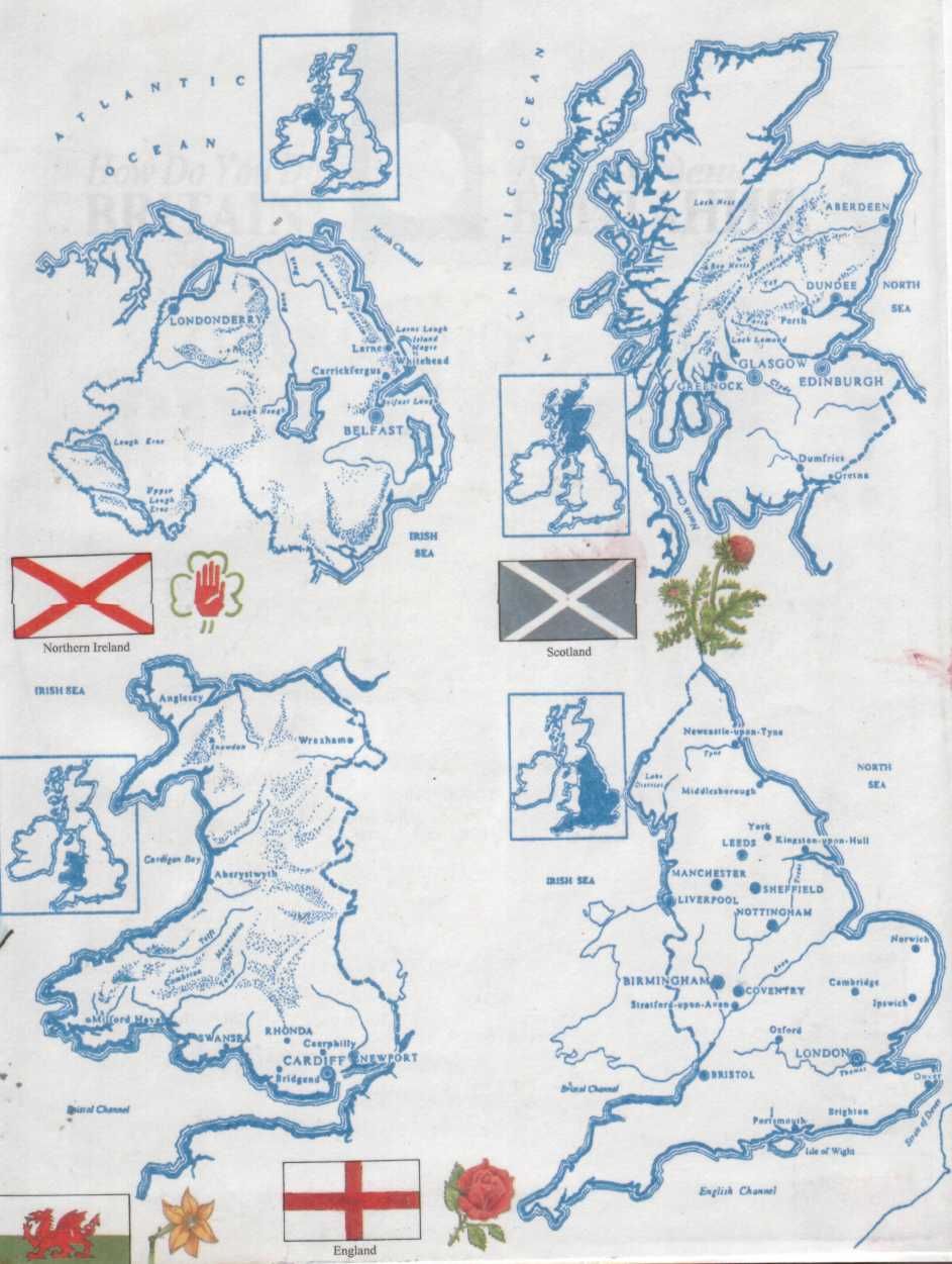
Unit 10. Wales
Unit 11. Northern Ireland — the Land of the Giant's Causeway
Unit 12. Great Britain — a Constitutional Monarchy
Unit 13. Mother of Parliaments
Unit 14. The Party System and the Government
Unit 15. The Press
Unit 16. Radio and Television
Unit 17. The School Education
Unit 18. The Public Schools
Unit 19. The Economy. The South
Unit 20. The Regions of Britain
Unit 21. Transport
Unit 22. Agriculture
Unit 23. Food and Meals
Unit 24. Some National Traits
Unit 25. The Church In Modern Life
Unit 26. The British In Their Private Life
Unit 27. English Gardens and Gardeners
Unit 28. Leisure and Sports
Unit 29. King Arthur
Unit 30. My Bonnie Lies Over the Ocean
Unit 31. Canterbury Cathedral and Geoffrey Chaucer— the Great English Storyteller
Unit 32. Shakespeare and Shakespeareland
Unit 33. Britain's Great Hero
Unit 34. The Lady With the Lamp
Unit 35. Museums and Other Treasures
Appendices
Chronological Outline
Kings and Queens of England from Alfred
British Prime Ministers and Governments
A Country Across the Channel
The British Isles, which include Great Britain, Ireland and a lot of smaller islands, are situated off the north western coast of Europe and once formed part of that continent. They became islands when they were separated from it. The separation took place thousands of years ago, after the last Ice Age, when the ice melted, the level of the oceans rose and drowned the low-lying coastlands.
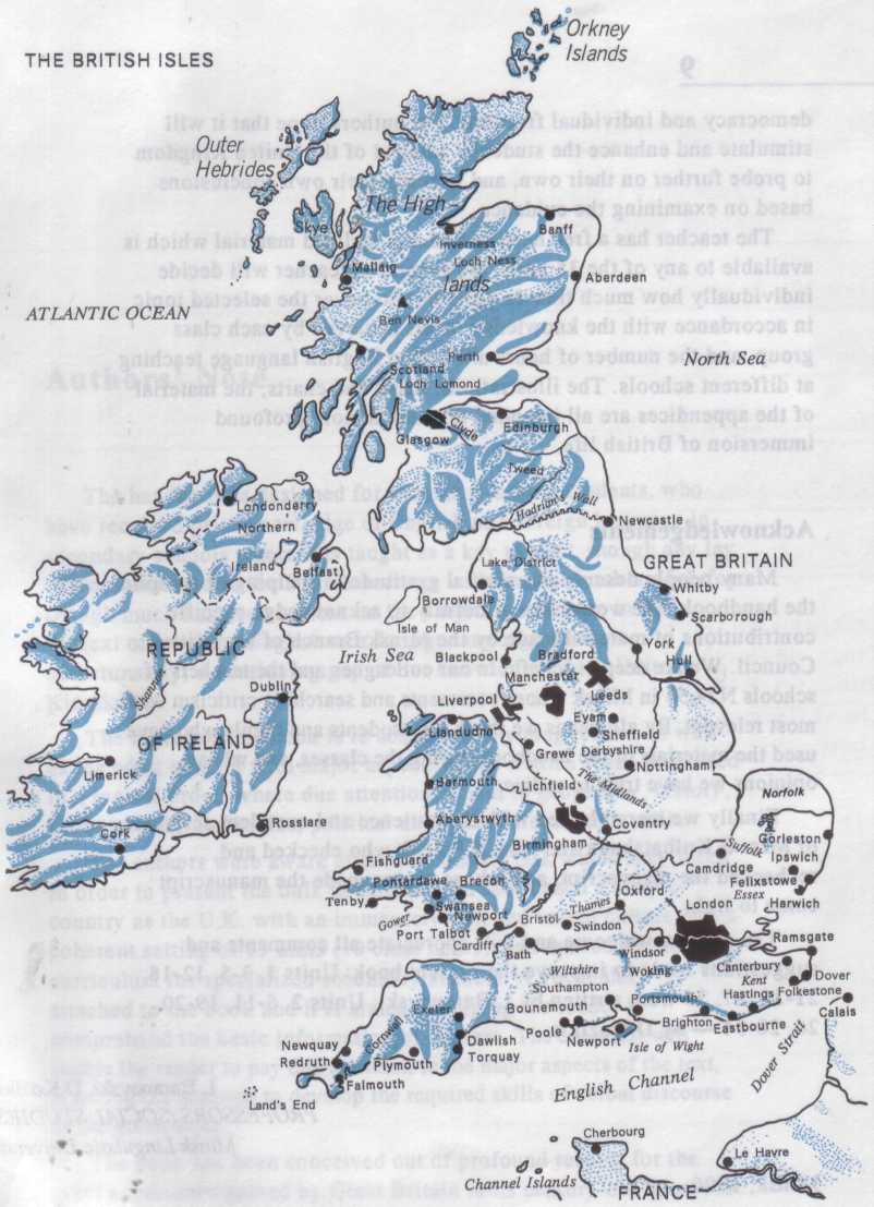
Politically the British Isles are divided into two countries — the United Kingdom of Great Britain and Northern Ireland, and the Irish Republic or Eire. All in all there are over 5,000 islands in the system of the British Isles which lie on the continental shelf, the zone of shallow water surrounding at present the continent and resembling a shelf above the deep water of the oceans.
The British Isles lie between longitudes 2°E and 11°W and latitudes 50 and 61°N. Yet the country has a relatively mild climate throughout the year due to maritime influences. The warm waters of the North Atlantic Drift (Gulf Stream) move from the Gulf of Mexico and the Caribbean Sea across the Atlantic, and so reach the shores of Northwest Europe. That is why in winter the coasts are free of ice and the warm air passes over the British Isles throughout the year.
From the European continent the British Isles are separated by the English Channel and the North Sea. The English Channel, in its widest part in the west is 220 km wide, and in the narrowest, what is called the Strait of Dover, only 32 km. So, the islands have had an easy and mainly profitable contact with mainland Europe. In the past there were a number of schemes how to connect the two coasts. In 1994 the dream came true: the construction of the two-rail tunnel was completed and it was opened for public use.
The most important sea routes pass through the English Channel and the North Sea linking Europe with the Americas and other continents. The advantageous geographical position of Great Britain created favourable conditions for the development of shipping, trade and the economy as a whole.
However, the true value of Britain's geographical position has not always been obvious. Indeed, it clearly emerged in the late 15th and 16th centuries, a period which saw the discovery of America and the opening of the sea route round the Cape of Good Hope to the Far East. Before this time European civilization had been centred in the Mediterranean lands. The British Isles, although developing slowly, were on the margins of this civilization. With the discovery of the Americas the British Isles became an intermediary between Europe and the New World.
From the 16th century onwards, the wealth and influence of Great Britain increased rapidly. With the acquisition of overseas colonies and the establishment of an empire she attained the status of a world power. Her position as such was emphasized by the Industrial Revolution of the 18th and 19th centuries, which was based on her resources of coal and iron and on the markets she had established throughout the world. By Victorian times (1837-1901) Great Britain had become the richest country in the world, the first great modern industrial and capitalist society.
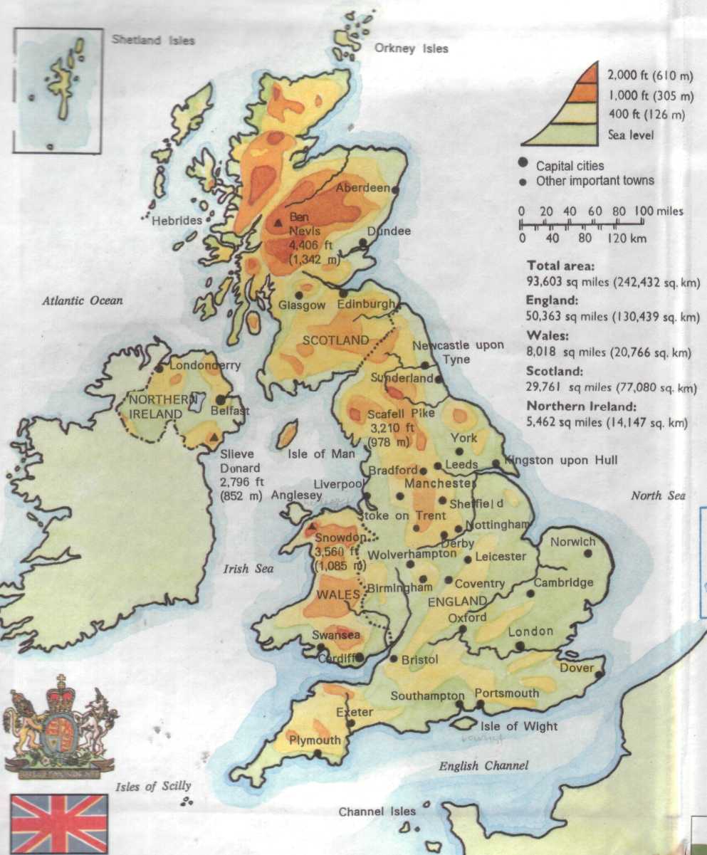
During the 20th century Britain has lost this position and her economy has faced increasing problems, especially with the collapse of the empire. The problems of supporting her population (57 million) on such a small land area (244,100 sq km) are also obvious. At the same time, however, it is important to remember that Britain, with the benefits of North Sea oil production, is still one of the leading industrial and trading countries in the world.
The British Isles in general, but especially England, form one of the most densely peopled areas in the world. Archaeologists and historians have demonstrated that the present-day inhabitants of Britain and Ireland are largely the descendants of settlers and traders from western Europe, who came to these islands in a series of invasions, from about 2500 B.C. d6wn to the Norman Conquest of 1066. The growth of population in Britain reflects, to a large extent, the economic changes. The basic population distribution of the 20th century had been established by the Industrial Revolution and the increase in population of the 19th century.
The British Isles, apart from Great Britain and Ireland, the two largest islands, include several other important islands and groups of islands. Off the northwestern coast of Great Britain there is a group of islands known as the Hebrides. They are divided into the Inner and Outer Hebrides. They are separated from each other by the Sea of the Hebrides and the Little Minch. The main occupation of people here is farming combined with fishing.
Off the northern coast of Scotland, separated from the mainland by the stormy Pentland Firth are the Orkney Islands, comprising about a hundred islands. Most of the people (about 20,000) are engaged in dairy and poultry farming, bacon, cheese and eggs are exported to Central Scotland.
The Shetland Islands are situated about 70 miles north of the Orkneys. They provide thin poor soils suitable only for rough pasture. The population (18,000) is actively engaged in herring-fishing. Apart from fish, the only exports from the islands are Shetland ponies and lace knitted from the wool of local sheep.
In the middle of the Irish Sea there is the Isle of Man (571 sq km). The island is administered by its own Manx Parliament and has a population of about 50,000 chiefly engaged in farming, fishing and tourist trade. The largest settlement is the holiday resort of Douglas (23,000). Another important island in the Irish Sea is Anglesey, situated off the north coast of Wales. Anglesey contains only 52,000 people, and more of the working population are now engaged in industry than in fishing and agriculture. This is due partly to an increase in the tourist trade and partly to the introduction of several new industries, for example, the construction and operation of the nuclear power station at Wylfa.
The Isle of Wight is in the English Channel. It is diamond-shaped, 40 km from west to east, and about half as much from north to south. The Isle of Wight lies across the southern end of Southampton Water, and is separated from the mainland by the Solent. With its sunny beaches and pleasant varied countryside, the island forms one of the most important tourist resorts. It is linked to London by ferry and rail services. Also lying in the English Channel off the extreme south-western coast of Great Britain is a tiny group of the Isles of Scilly, another resort area.
The Channel Islands lie to the southwest on the French side of the English Channel. They are known to the French as the Isles Normandes. The Channel Islands form an archipelago, separated by shallow waters from northern France. As part of the Duchy of Normandy, they have been attached to the English Crown since the Norman Conquest (1066). The total area of the islands is only 194 sq km, but the population is over 130,000 what results in high density of population — 686 per sq km. In summer the population increases greatly by holiday-makers.
The chief islands of the group are Jersey and Guernsey. In rural areas many of the people speak a French-Norman dialect, but the official languages are English and French.
The British Isles are known for their greatly indented coastline. Therefore there are many bays and harbours, peninsulas and capes on the coast, which were formed as a result of the raising and submerging of the land surface in the process of the geological development of the islands. Due to its extreme identity the coastline of Great Britain, despite its relatively modest size, is 8,000 km long. Very much indented is the western coast, especially the coasts of Scotland and Wales.
The east coast is less lofty and more regular than the west coast, and the coastal lowlands are flooded frequently.
Hardly has anything been more important in British history than the fact that Great Britain is an island. Living on islands, and therefore near the sea, the inhabitants naturally grew into a nation of sailors. Their love of the sea led them to become navigators and discoverers of new lands in many parts of the globe.
The capital of the country, London, is an enormous city. Its name is probably derived from the Celtic Llyn, a pool or lake (the River Thames at an earlier period expanded into a considerable lake — the part immediately below London Bridge is still "the Pool"), and din or dun, a hill, fort, or place of strength. The "hill" may have been that on which St.Paul's now stands, or Cornhill.
When the Romans conquered Llyndun they Latinised the name as Londinium. Great military roads radiated from the city to various parts of Britain, and distances were measured from the lapis milliaris (mile-stone) in the Forum of Agricola, in the heart of the town. The stone, now known as the London Stone, may still be seen in the wall of St.Swithin's Church, Cannon Street.
Under the Saxons London became the metropolis of the kingdom of Essex. The city was constituted by Alfred the Great the capital of England, York and Winchester having previously enjoyed that dignity in succession — the former under the Romans, the latter under the Saxons. In 994, the first bridge accross the Thames was built.
The White Tower, in the Tower of London, was erected by William I in 1078, on the site of the Roman fort already noticed. The same king granted a charter to the city confirming the burghers in the rights enjoyed by them under Edward the Confessor. King John granted the citizens several charters, and in Magna Charta (1215) it was expressly provided that London should have all its ancient privileges and customs.
About 7 million people live in Greater London. The oldest part of London is the "City". Centuries ago, there was a high wall all round the City of London. Places like Soho and Chelsea were small villages outside the City. Now they are part of Central London.
There are always crowds of tourists in London. They visit London's many sights. Buckingham Palace and Westminster Abbey are two of the favourite ones. London is great for shopping. There are lots of big department stores, like the famous Harrods and Selfridges. People from many different countries live in London today, and their way of life has given London a new "face". If you want to see the latest ideas in fashion, go and look at the shops in the King's Road.
Comprehension Check